Barcelona Metro Line 4
(Yellow L4 line)
Updated: June 2025
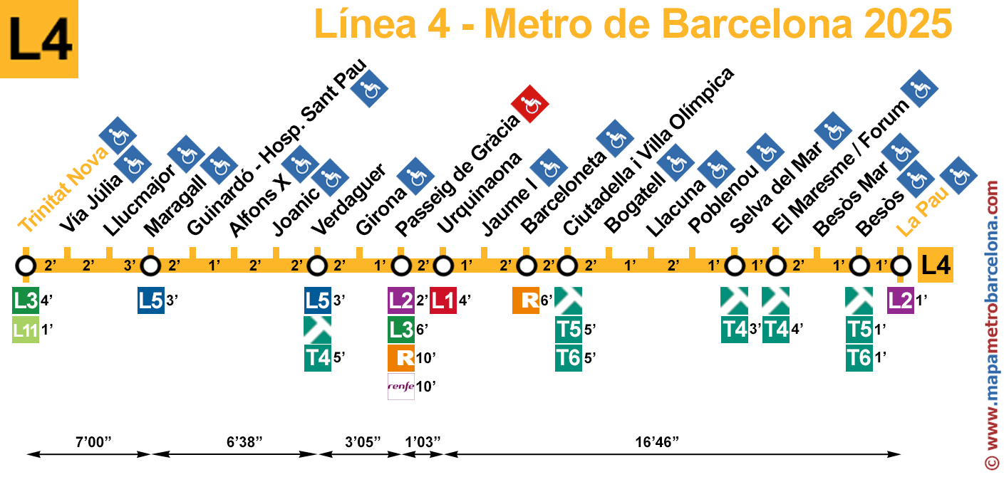
On this website, we exclusively have the most complete and updated map of Barcelona Metro line 4 (yellow line) on the Internet. We have created it from mapametrobarcelona.com.
Barcelona Metro Line 4.
In the following map, we have updated all the metro stops until June 2025, as the rest of the maps on other websites are missing things or are very outdated. All stations are in zone 1.
You can download the following map, print it, or do whatever you want, but reproduction on any other website is strictly forbidden, as well as direct links to the image.
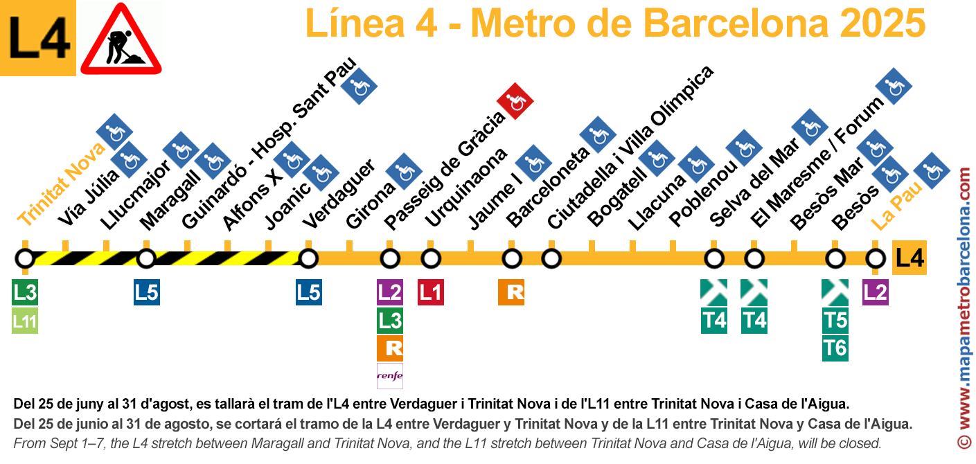
Metro line 4 map: UNDER CONSTRUCTION - SUMMER 2025:
From 25 June to 7 September, 6 km of track will be replaced. The works will force the suspension of services on sections of lines L4 and L11:
- Between 25 June and 31 August, there will be no service on L4 between Verdaguer and Trinitat Nova, or on L11 between Trinitat Nova and Casa de l'Aigua.
- From 1 to 7 September, the closure will move to L4 between Maragall and Trinitat Nova, while the L11 section between Trinitat Nova and Casa de l'Aigua will remain shut.
Our map may look like the typical one you can find at any station, but we have redesigned it from scratch with some unprecedented features, such as transfers to the new rapid buses, the duration between the most important metro stations, and we have also marked the metro stops that are adapted for people with wheelchairs, baby strollers, or luggage.
Important: The rapid bus stops (red circles) are between 50 and 300 meters from the metro stops.
The icon of a wheelchair in a red square means that in that station there are areas where wheelchairs cannot be used because there are stairs between the platform and the street. To know which stations are fully accessible for wheelchair users, please refer to the general metro map.
The following plan is another version, in case it is more interesting. It includes the time it takes to go from one station to another and the times to transfer to another line.
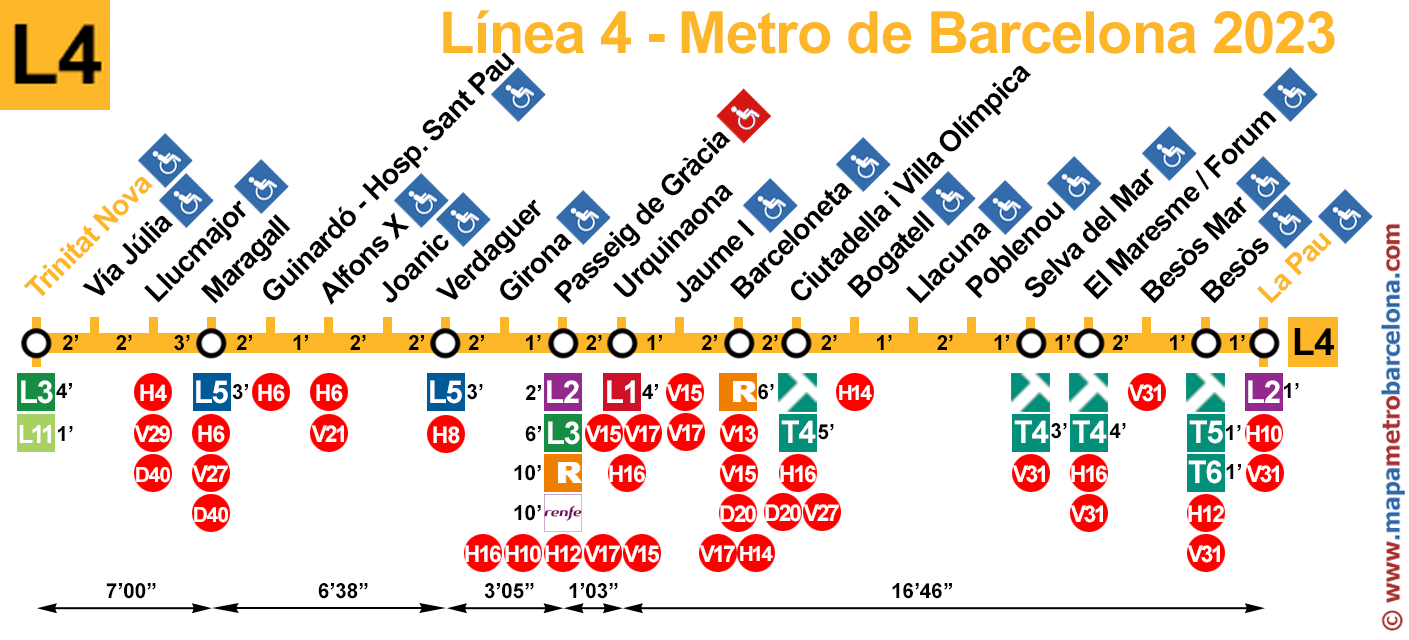
For now, we have only made this version for line 4. If someone finds it interesting, please write to us through the contact form and let us know. If nobody says anything, we will abandon this type of maps with times.
If you wish, you can also see the complete Barcelona metro map, a page with all lines together (but individually separated) or you can view the other lines one by one:
Line 1 | Line 2 | Line 3 | Line 4 | Line 5 | Line 6 | Line 7 | Line 8 | Line 9N | Line 9S | Line 10N | Line 10S | Line 11 | Map
Stations of Metro Line 4 (L4)
This is the list of all the stations of metro line 4 (yellow). Next to the name of the stop, we have added if a transfer to other transport is possible.
| Trinitat Nova | |
| Via Júlia | |
| Llucmajor | |
| Maragall | |
| Guinardó / Hospital de Sant Pau | |
| Alfons X | |
| Joanic | |
| Verdaguer | |
| Girona | |
| Passeig de Gràcia | |
| Urquinaona | |
| Jaume I | |
| Barceloneta | |
| Ciutadella / Vila Olímpica | |
| Bogatell | |
| Llacuna | |
| Poblenou | |
| Selva de Mar | |
| El Maresme / Fòrum | |
| Besòs Mar | |
| Besòs | |
| La Pau |
Legend
Metro lines: ![]()
![]()
![]()
![]()
![]()
![]()
![]()
![]()
![]()
![]()
![]()
FCG train lines:
![]()
![]()
![]()
![]()
![]()
![]()
![]()
![]()
![]()
Regional train lines: ![]()
![]()
![]()
![]()
![]()
![]()
![]()
![]()
![]()
![]()
Tram: ![]()
![]()
![]()
![]()
![]()
![]()
![]()
High-speed train lines:
![]()
Bus station: ![]()
Funicular: ![]()
Cable car: ![]()
Seaport: ![]()
Zoo: ![]()
Information point: ![]()
Wheelchair accessible stop: ![]()
Wheelchair inaccessible stop: ![]()
Partially wheelchair accessible stop: ![]()
The "partially wheelchair accessible" metro stops mean that you can access the street with a wheelchair, but there are stairs when transferring to other lines.
If you have found an error or have any ideas for improvement, send us a message.
Thank you for visiting our page! We hope the map of Barcelona's metro line 4 has been helpful to you.