Maps of the Underground lines Barcelona 2025
Here are the maps of lines 1, 2, 3, 4, 5, 6, 7, 8, 9, 10, 11 and 12 of the Barcelona metro, the most complete and current Internet (June 2025). We use much the Barcelona metro and so we created the maps we'd have us.
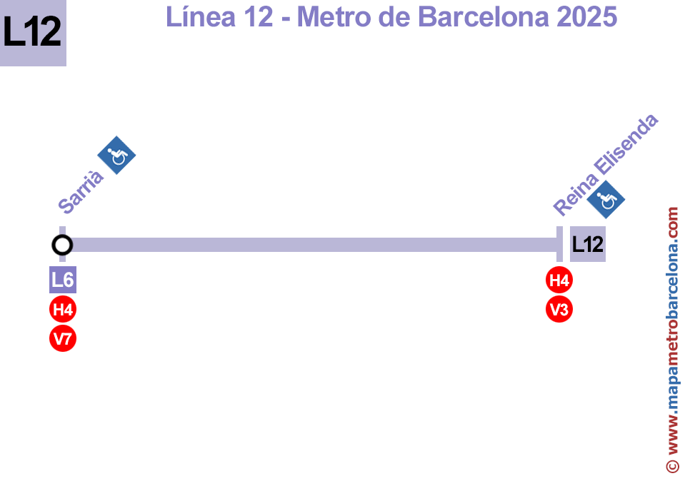
Line 1 | Line 2 | Line 3 | Line 4 | Line 5 | Line 6 | Line 7 | Line 8 | Line 9N | Line 9S | Line 10N | Line 10S | Line 11 | Line 12 | Map
All line maps of the Barcelona metro:
In the map below we have updated all subway stops until June 2025. We have tried to be as accurate as possible.
You can download the map below, print it or do whatever you want, but reproduction is strictly prohibited on any other website, and link directly to the image.


Legend
Metro lines: ![]()
![]()
![]()
![]()
![]()
![]()
![]()
![]()
![]()
![]()
![]()
FCG train lines: ![]()
![]()
![]()
![]()
![]()
![]()
![]()
![]()
![]()
Regional train lines: ![]()
![]()
![]()
![]()
![]()
![]()
![]()
![]()
![]()
![]()
Tram: ![]()
![]()
![]()
![]()
![]()
![]()
![]()
High-speed train lines: ![]()
Bus station: ![]()
Funicular: ![]()
Cable car: ![]()
Seaport: ![]()
Information point: ![]()
Wheelchair accessible stop: ![]()
Wheelchair inaccessible stop: ![]()
Partially wheelchair accessible stop: ![]()
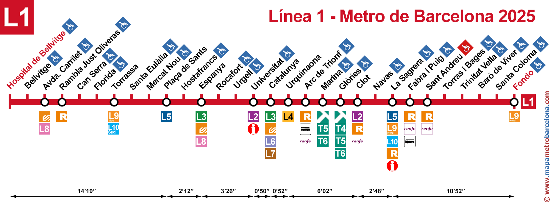
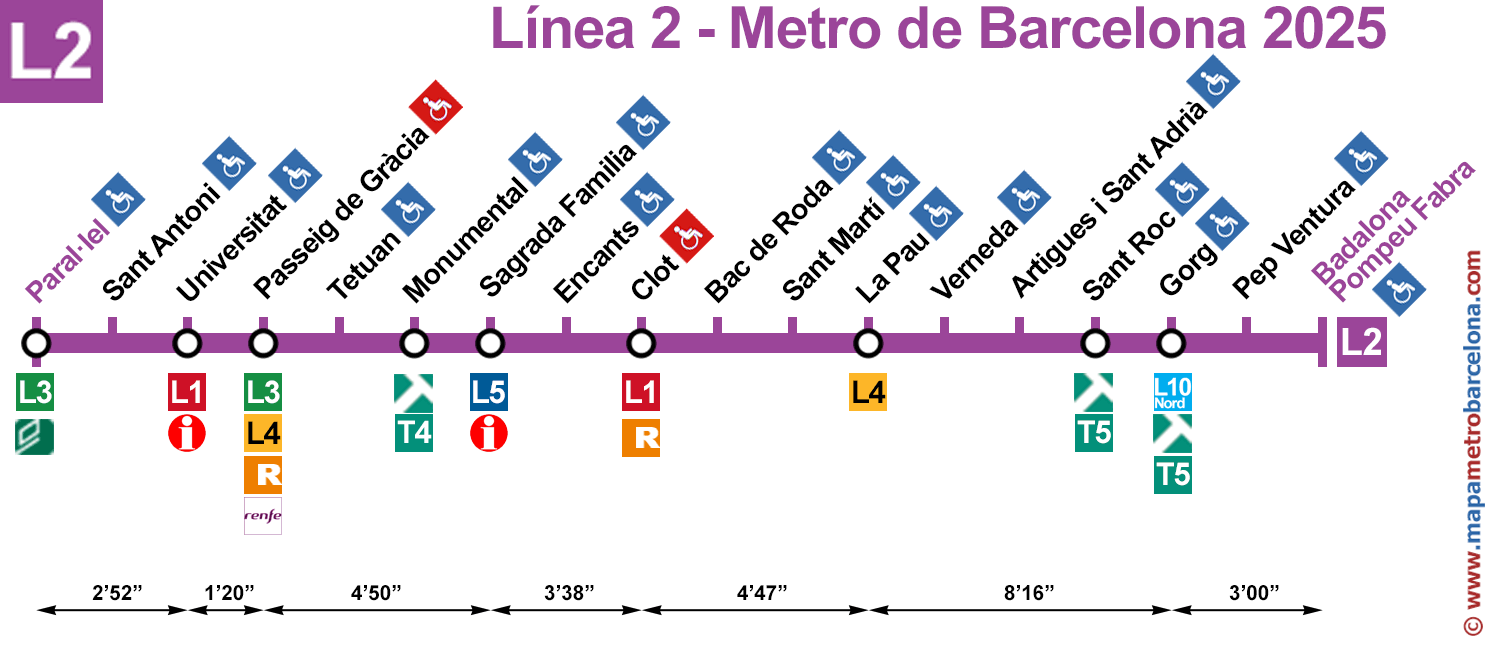
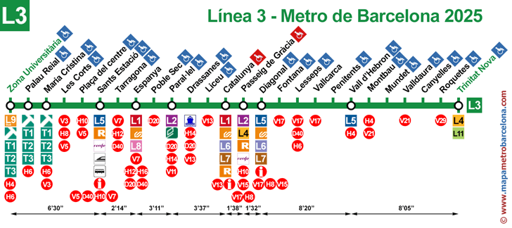
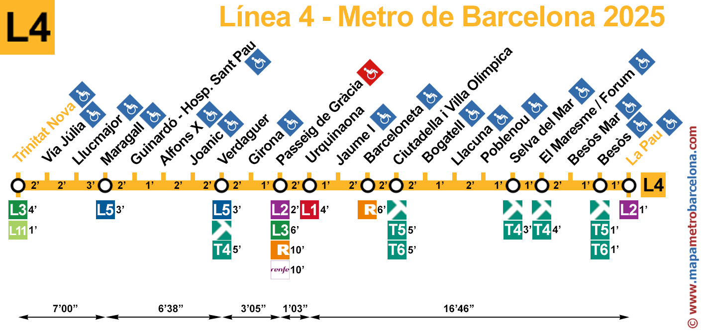
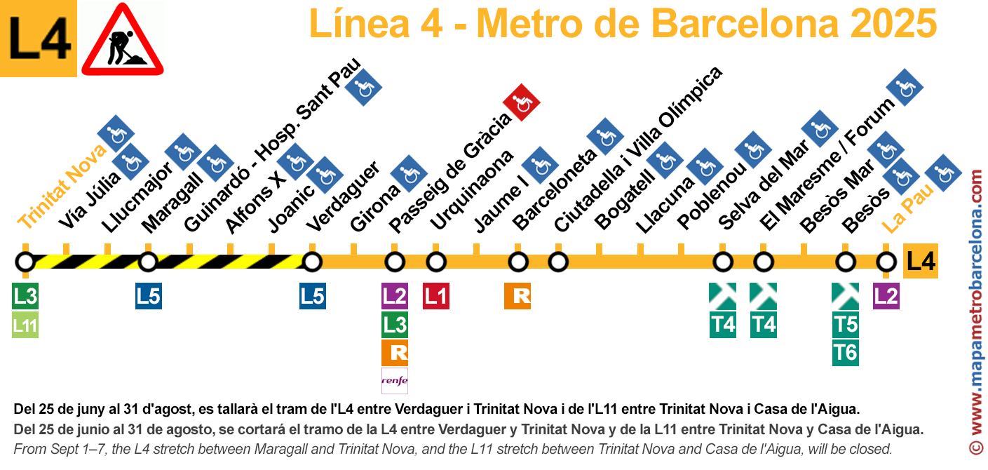
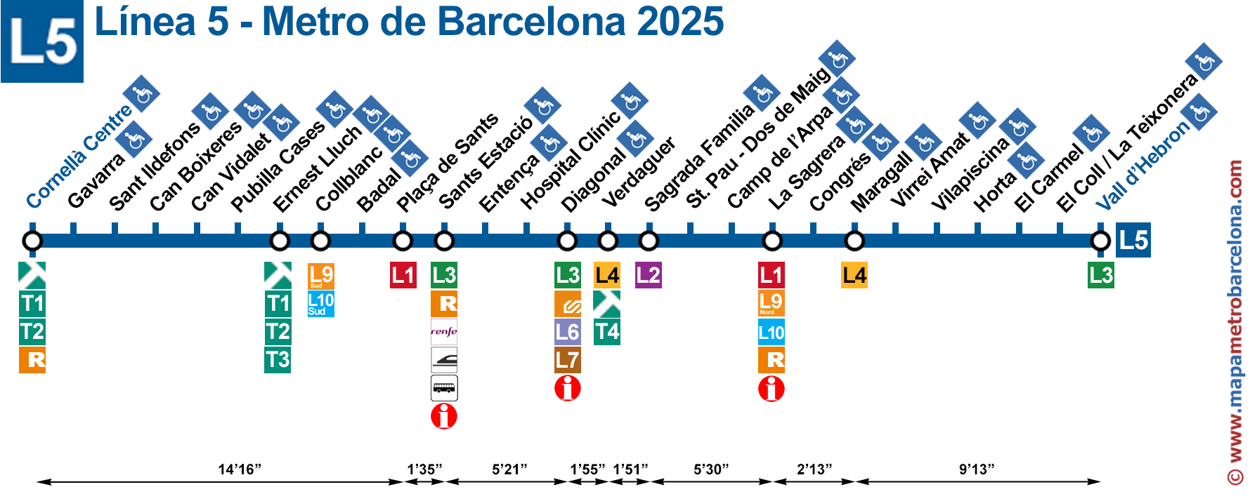
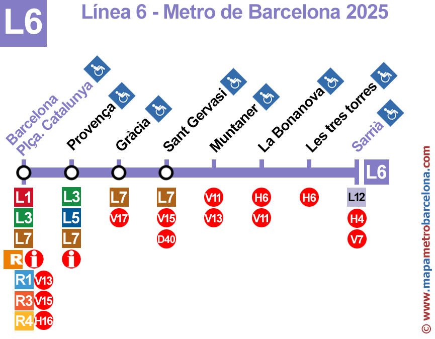
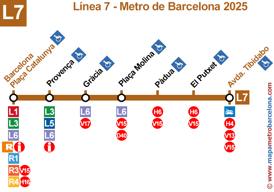
The "partially wheelchair accessible" metro stops mean that you can access the street with a wheelchair, but there are stairs when transferring to other lines.
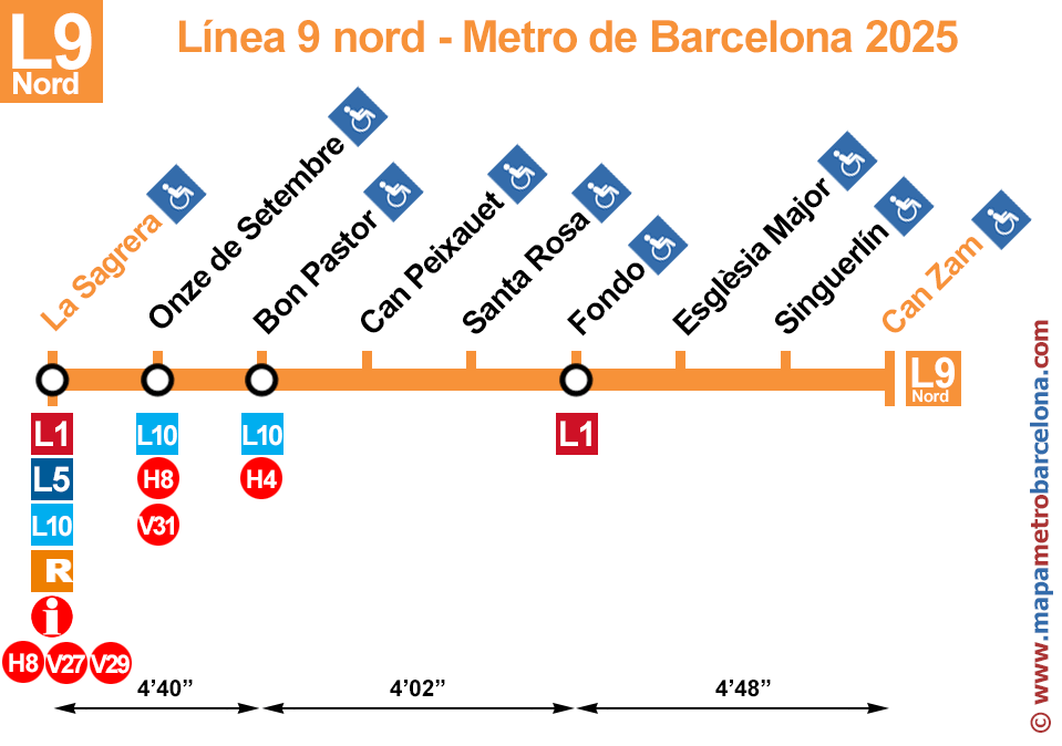
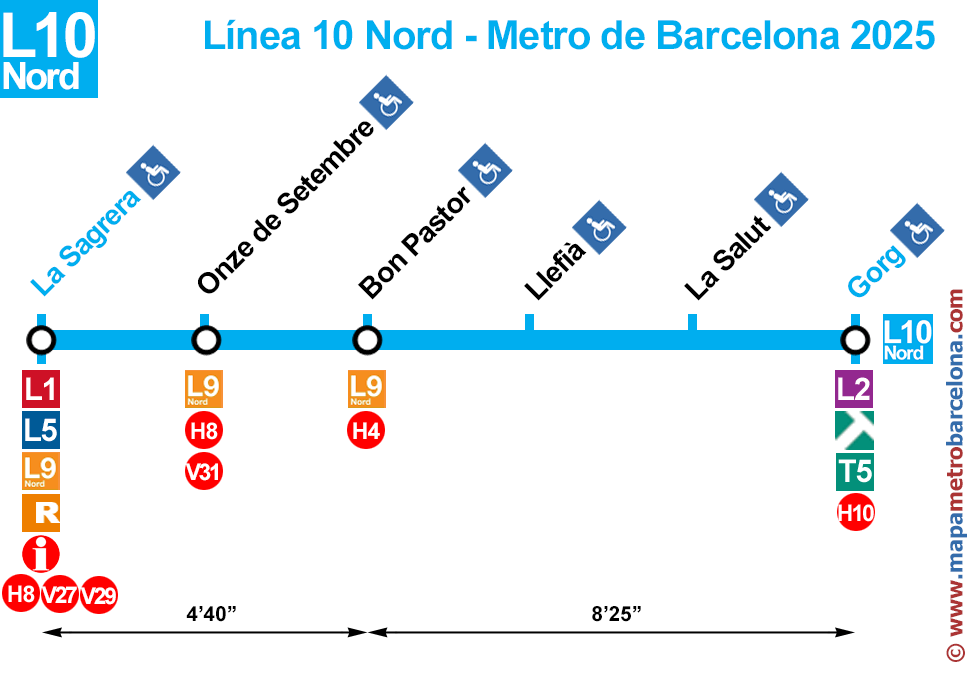
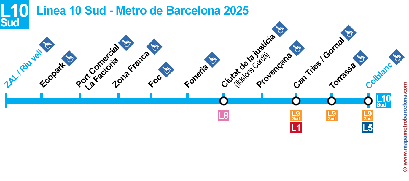
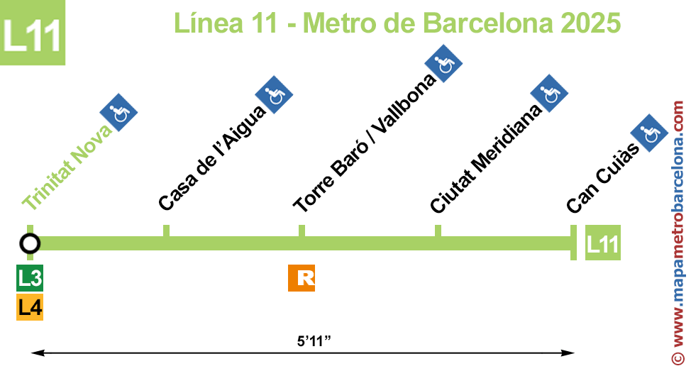
The above maps indicate the Barcelona subway lines, stops with transshipments with other transport and the stops are adapted for people who are in wheelchairs, prams or luggage.
Important: The express bus stops (red circles) are between 50 and 300 meters from the metro stops.
The drawings station adapted to wheelchairs, etc, are blue, but if the design is red, it means that at that station can go out by elevators, but can NOT transfer to all other lines there also at that station.
For example in the metro station Passeig de Gràcia, you can go from the yellow line (L4) to the purple (L2) and vice versa, but the green line (L3) in station Passeig de Gràcia has no elevator, no to go out or to transfer to the yellow (L4) and purple (L2) lines. In these metro stops see our full barcelona metro map for more details.
The arrows and numbers on the bottom of each plane, indicating the journey between stations indicating arrow (in minutes and seconds). For example in the last shot of line 11, we can see that a Nova Trinitat Can Cuiàs takes five minutes and eleven seconds.
If you wish, you can also see the full barcelona metro map, or see the map of the lines individually:
Line 1 | Line 2 | Line 3 | Line 4 | Line 5 | Line 6 | Line 7 | Line 8 | Line 9N | Line 9S | Line 10N | Line 10S | Line 11 | Map
Feel free to contact us regarding any fault or defect, indicating the station name and we will correct it.
Thank you very much for your visit, we hope that our Barcelona Metro Map by lines has been useful to you.